Batcat
The United States Air
Force
553rd Reconnaissance
Wing
Korat Royal Thai Air
Force Base
Korat
RTAFB
Satellite Views
2012
Korat Satellite View
area added 09/04/12, Last updated
09/30/12.
The images which follow came from using
Google map to view Korat, then switching to the satellite view of
the map area. I downloaded these images during September 2012,
however I don't know precisely when they were
taken.
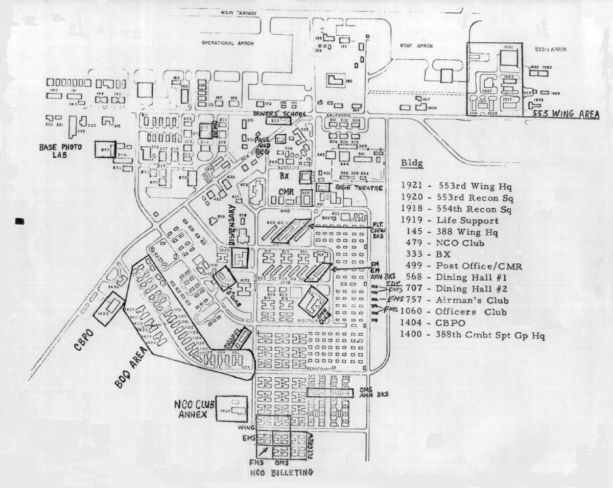
Although this is from the war years
(1967-1971), this will give you an idea of Korat's base
layout by viewing this Korat Royal
Thai Air Force Base Map. Map courtesy of
Jim Bartholomew.
B&W, about 183K, Added
09/28/02.
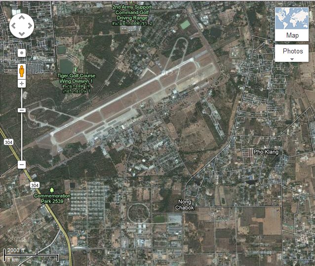
David Sasiela sent
information that these satellite views were taken January 30, 2011.
Added 09/30/12
Korat RTAFB
views
from Google Map Satellite views
- This is an Overview
of Korat Royal Thai Air Force Base. Shows the full runway,
with housing below the runway. About 120K. Added 09/04/12.
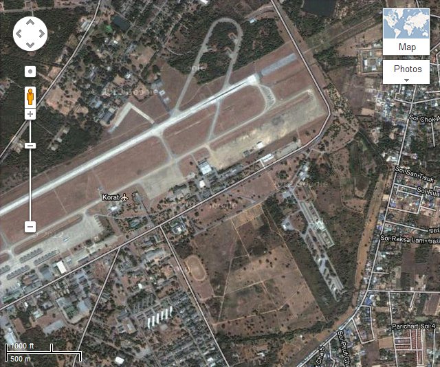
- This is a view of the northeast
end of runway 3/21. The phase dock hangar shown just about
middle of the image, with what was the Connie ramp extending up
and to the right. About 114K. Added
09/04/12.
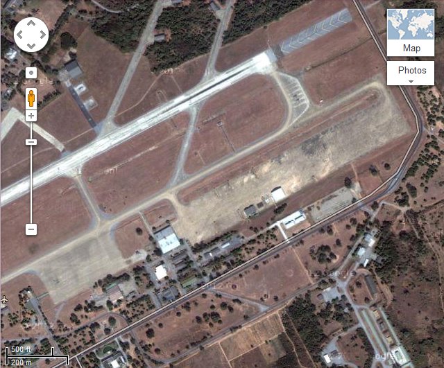
- This is a zoomed
in further view of Korat RTAFB. The phase dock hangar is at
the lower left of the Connie ramp. There appears to be two
buildings on the Connie ramp which weren't there when I was
at Korat 68-69. About 98K. Added
09/04/12.
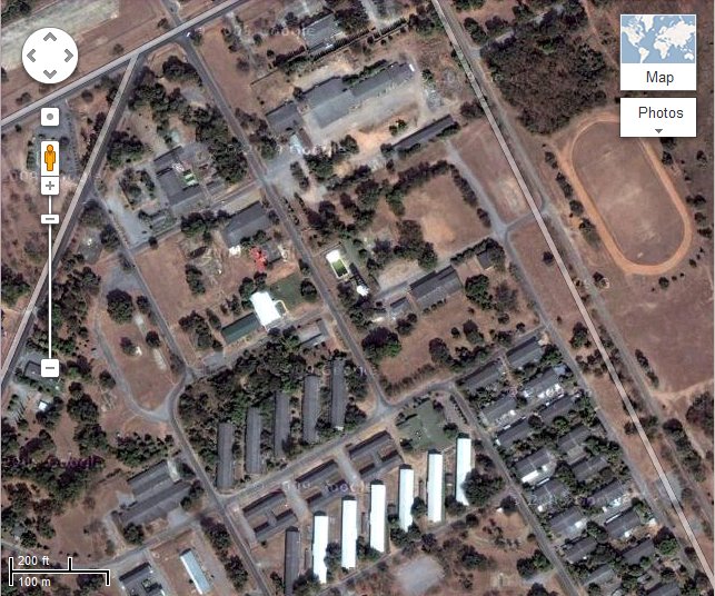
- this image at the same magnification as
koratRTAFB-03.jpg, with
the center moved so the base swimming pool is about center.
Pool shows as some white, then a little green, then greener. The
Consolidated Mail Room (CMR) is to the left and a little lower
shows as a white topped building. The Base Exchange is above the
CMR. The angeled dark roof building are the barracks, two of
these were for enlisted flight crew. There are also white roofed
angeled barracks the top right being for enlisted FMS. The area
immediately below the white roof barracks is where the Swadee
Club (Airmans Club) once stood, now there is nothing but an over
grown field. About 116K. Added
09/04/12.
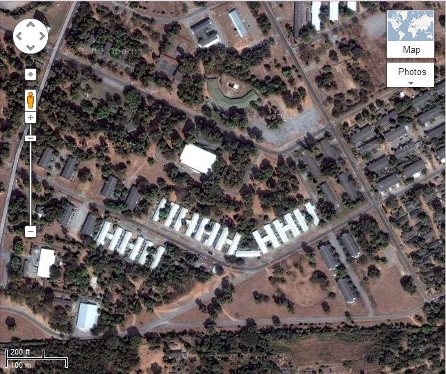
- this image at the same magnification as
koratRTAFB-03.jpg, showing
further east and south. The white roof buildings at the lower
left are what were the Bachelor Officer Quarters (BOQ). Not sure
about the white roofed building in the middle. Believe the
crescent shaped building with a dark roof, is what was the
Officers Club (Kaboom Club) with again a dirty looking pool.
About 124K. Added
09/04/12.
Return to the
 Main Batcat homepage.
Return Home to Larry and Sue's
Homepage.
to Larry and Sue's
Homepage.